Thursday, November 11, 2010

Tour to Rocks

Tungabhadra Dam, Hampi, Badami, Mahakuta, Pattadakal, Aihole, KudalaSangama, Almatti Dam, GolGumbaz, JamiMasjid, Gokak Falls, Saundatti, Chitradurga

Trip Members: Me, Surendra, Ravi, Sony
Mode of transport: Swift Car
Date of trip: 29th Oct 2010 Friday 9 PM to 1st Nov 2010 Monday 10 PM
Total distance covered from Bangalore: Around 1500 Kms

TungaBhadra Dam- Hospet
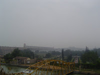
Distance: Around 320 Kms from Bangalore
Route we took: Bangalore-Tumkur- Chitradurga-Hospet
Place Type: Dam
Time of our visit: 30th Oct Saturday around 7 AM
Description: TB dam was full when we visited the place and view from the top of the dam looked like a sea. TB dam premise also has a garden with musical fountain.

Hampi
Distance: Around 15Kms from Hospet
Route: Hospet- Hampi
Place Type: World Heritage Site
Time of our visit: 30th Oct Saturday around 9 AM
Description: Hampi is a world heritage site which has ruins of Vijayanagar empire located along TungaBhadra river. There are lots of places to see in Hampi and the places are quite far from each other. We hired a Auto for Rs 400, the Auto driver was also our guide and he took us around all of Hampi and with the help of him we saw most of the major places of Hampi in 4 Hrs. The Architecture of sculptures and different kinds of places is wonderful and one can have good imagination of vastness of the Vijaynagar empire. It requires more than a day to fully visit all the places. Some of the wonderful places of Hampi we saw are Kadalekalu Ganesha, Sasivekalu Ganesha, Krishna temple, Statue of Ugra Narasimha, Badavilinga Temple, Akka Tangi Gudda, Zenena Enclosure, Lotus Mahal, Elephant stables , Guard’s quarters, Archeological Museum, Hazara Rama temple, Mahanavami Dibba, Stone Doors, Queen's bath, Vittala temple.

Daroji Bear Sanctuary
Distance: Around 15 Kms from Hampi
Route: Hampi- Bear Sanctuary (Ask for directions from Hampi)
Place Type: Wild Life
Time of our visit: 30th Oct Saturday around 2.30 PM
Description: Forest Officer told that there around 120 bears and one can usually see around 4-8 bears if we wait for around 2 hrs from the watch tower which is built inside the sanctuary. We waited for around 20 minutes for bears and we did not see any bear but we only saw some peacocks. It was cloudy and it began to rain after waiting for 20 Mins, forest guard told that bears don’t come out during rain. Entry ticket is Rs 30 per individual and Rs 150 for our car. After visiting the Sanctuary we felt that, it was not worth the visit

Banashankari
Distance: Around 150 Kms from Hospet
Route: Hampi- Hospet- Banashankari (ask for directions)
Place Type: Religious
Time of our visit: 30th Oct Saturday around 8 PM
Description: We made a quick visit to Banashankari which has a temple dedicated to goddess Banashankari and the temple is just 5 Kms from Badami

Badami
Distance: Around 155 Kms from Hospet
Route: Hampi- Hospet- Badami (ask for directions)
Place Type: Archaeological Site
Time of our visit: 31st Oct Sunday around 7 AM
Description: Badami has amazing four cave temples in four floors dedicated to Vishnu, Shiva and Jain temple built by Chalukyas in 6-7th Centuries. Caves are beautifully carved and one can have a good view of Agasthya-Tirtha Lake, Bhoothanatha temple from the top. One can also visit Bhoothanatha temple, Archaeological Museum and climb to top of the fort which lies at the opposite side of the caves. Ask for directions; Roads are bad and narrow.

Mahakuta
Distance: Around 15 Kms from Badami
Route: Badami - Mahakuta
Place Type: Religious
Time of our visit: 31st Oct Sunday around 10 AM
Description: We visited Mahakuta temple which is on the way from Badami to Pattadakal. Mahakuta has temples constructed by the early kings of the Chalukya dynasty. I can remember seeing sculptures of Brahma, Vishnu and Maheshwara deities inside the temple complex.

Pattadakal
Distance: Around 22Kms from Badami
Route: Badami- Pattadakal
Place Type: World Heritage Site
Time of our visit: 31th Oct Sunday around 10.30 AM
Description: Pattadakal is a world heritage site which has group of monuments built by Chalukya dynasty along Malaprabha River. The architecture and sculptures of all the temples are remarkable and is very well maintained by the concerned authorities.

Aihole
Distance: Around 20 Kms from Pattadakal
Route: Pattadakal - Aihole
Place Type: Archaeological Site
Time of our visit: 31st Oct Sunday around 12 PM
Description: Aihole has a group of temples; some of them located close to village houses. I particularly remember some enthusiastic kids showing us Inverted image of an object in a pillar and Linga where one can see reflection of Nandi; the temple was located outside the main group of temples and is first/second temple one sees when travelling from Pattadakal. Intricately carved sculptures at the main Durga Temple are incredible and there is also a museum located within the temple complex maintained by archaeological survey of India.

KudalaSangama
Distance: Around 45 Kms from Aihole
Route: Aihole - KudalaSangama
Place Type: Pilgrimage
Time of our visit: 31st Oct Sunday around 1.30 PM
Description: Kudalasangama is a pilgrimage center and has a temple dedicated to Shiva. Basavanna who is a 12th century social reformer samadhi is present in Kudalasangama. View from the bridge which is inside the temple complex is amazing and one can see Krishna river and Ghataprabha river getting merged

Almatti dam
Distance: Around 15 Kms from KudalaSangama
Route: KudalaSangama – Almatti Dam
Place Type: Dam
Time of our visit: 31st Oct Sunday around 3.00 PM
Description: Almatti dam is built across Krishna River and visitors to the dam are not allowed. There is some kind of park where one can see waters of the dam and one can also visit a park which is near the entrance to the dam.

GolGumbaz
Distance: Around 60 Kms from Almatti dam
Route: Almatti Dam- Bijapur
Place Type: Archaeological Site
Time of our visit: 31st Oct Sunday around 5.00 PM
Description: GolGumbaz has one of the world largest dome and was constructed by Mohammed Adil Shah. GolGumbaz has a whispering gallery and one can see lots of people shouting as it get echoed around 7 times. Anyone talking from one corner of the gallery can be heard clearly on the diagonally opposite side by holding your ears to the wall. GolGumbaz premises is very well maintained by archeological survey of India.

JamiMasjid – Bijapur
Distance: Around 2 Kms from GolGumbaz
Place Type: Mosque
Time of our visit: 31st Oct Sunday around 5.50 PM
Description: We visited Jami Masjid built by Ali Adil Shah to commemorate the victory of Vijayanagara. It houses golden written copy of the Holy Koran.

Gokak Falls
Distance: Around 150 kms from Bijapur
Route: Bijapur - Jamkhandi - Gokak
Place Type: Falls
Time of our visit: 1st Nov Monday around 6.15 Am
Description: Gokak falls is located at 6 Kms from Gokak and Ghataprabha river takes a leap. There is a view point across the river which can be crossed using the hanging bridge. We were bit disappointed with very less water flowing and we soon got over it by seeing stunning sun rise.

Saundatti
Distance: Around 60Kms from Gokak
Route: Gokak- Saundatti (Ask for directions)
Place Type: Reservoir, Pilgrimage
Time of our visit: 1st Nov Monday around 10 AM
Description: We saw Renuka Sagara a reservoir for the Malaprabha River from a beautifully maintained park with variety of flowers and visited ancient temple of Goddess Renuka Yellamma; a popular pilgrimage site.

ChitraDurga Fort
Distance: Around 270 Kms from Saundatti, 210 Kms from Hubli
Route: Saundatti- Dharwad- Hubli- Haveri- Ranebennur – Davangere (NH-4)
Place Type: Fort
Time of our visit: 1st Nov Monday around 4.30 PM
Description: Chitradurga fort has a huge area and perhaps requires a day to cover all the hills view points. We visited one hill view point and it was quite tiring. The attraction of the fort is Obavanna Kindi named after onake Obavva who fought against several Hyder Ali’s soldiers. Movie Nagara Havu by Puttanna Kanagal has made Chitradurga fort very popular.

The title of this blog is tour to rocks; as we saw dams, great temple architecture, caves, golgumbaz, fort; all related to rocks and even Gokak falls was full of rocks

-Mahesh

Thursday, October 7, 2010

Mystery Trails

MMHills-Naagamale-Palar-Hogenakkal Falls
Mystery trails is a two day trek which starts from MMHills and you go through beautiful and mythically mentioned landscapes. The first day's stop will be at Naagamale. Second day you will start trekking towards Palar on the beautiful paths endowed with ample beauty of nature.

Route we took to MMHills: Bangalore- Maddur-Malavalli-Kollegala-MMHills
Alternate route: Bangalore-Kanakapura-Halgur-Malavalli-Kollegala-MMHills
Distance from Bangalore- Around 225 Kms
Date of our trek: 18 Sep 2010 – 20 Sep 2010
Total distance to be trekked: 24 kms
Trek difficult level: Moderate
Total Trek Members: 15
Trek was organized by Nishaad-3QN (http://www.nishaad3qn.org/) http://www.facebook.com/pages/NISHAAD-3-QUARTERS-NATURE/135025922910?ref=ts
About Mystery Trails: http://www.mysterytrails.com/

Few Points from our trek:
  • Get permission from Forest department. Discuss forest department charges , otherwise you might be in for some surprises
  • Male Mahadeshwara (MM) Hills has a temple dedicated to Lord Mahadeshwara who is said to be the incarnation of Lord Shiva
  • MMHills to NaagaMale (14 Kms): Need to climb up down few hills and you will also find quite a few villages on the way. One can see amazing view of Shola forest from the top of the hill. There is huge Snake and Linga rock formation at Naagamale.
  • Naagamale to Palar (10 Kms): The trek path is scenic with not much altitude variations and can be covered with less difficulty
  • Hogenakkal Falls: Is around 30Kms from Palar. Kaveri river was flowing full and the view from both Karnataka and Tamilnadu side was spectacular.
  • Animal sighting: We saw some wild boars and two foxes on the way from Palar to MMHills
Some Snaps:


-Mahesh

Wednesday, September 8, 2010

Monsoon trip

Horanadu - Kalasa - Kudremukha - Sringeri - Agumbe - Kuppalli - Mandagadde - Sakrebailu - Gajanur - Bhadra Reservoir

Trip Members: Me, Surendra, Ravi and Nandish
Mode of transport: Swift Car
Date of trip: 30th July 2010 Friday 9 PM to 1st August 2010 Sunday 9 PM
Total distance covered from Bangalore: Around 950 Kms

Horanadu:
Distance: 330 Kms from Bangalore
Route we took: Bangalore-Tumkur-Arsikere-Chikamagalure-Horanadu
Place Type: Religious - pilgrimage
Places to see: Sri Annapoorneshwari temple
Time of our visit: 31st Jul around 8 AM
Weather: It was raining regularly with occasional break from the rain god
Description: Sri Annapoorneshwari temple is the place to be seen in Horanadu and the temple has very beautiful sculpture of the goddess Annapoorneshwari. Facilities are quite good to get refresh and one can also buy good quality coffee, dry fruits in the shops surrounding the temple. Breakfast in one of hotels we had was bad and it is better to have free food offered by the temple.

Kalasa:
Distance: 7 Kms from Horanadu
Place type: Religious-Pilgrimage
Places to see: Kalasa temple
Time of our visit: 31st Jul around 10 AM
Description: Kalaseshwara Temple dedicated to Lord Shiva is present in Kalasa. The temple is pretty good, cleanly maintained and one can have good view of kalasa town from the top

Kudremukha:
Distance: 20 Kms from Kalasa
Place Type: Nature, Scenic, Water Falls, Dam, Trekking
Places to see: Kudremukh Iron Ore Company Limited (Need to get permission), Lakya Dam, Hanumanagundi falls, Tunga and Bhadra river Origin
Time of our visit: 31st Jul around 11AM
Weather: Frequent rain with occasional break
Description: On the way from Kalasa to Kudremukha we saw picturesque tea gardens. One has to give vehicle and occupants details at the forest checkpost at Kudremukha forest reserve entrance. Stop near the bridge for stunning view of the river surrounded by hills. Lakya dam is the best place to be seen inside Kudremukha forest reserve and photography is not allowed inside the lakya dam premises. It was raining heavily when we visited Hanumanagundi falls and we get a different view of falls during rainy season and it was worth the experience. Driving inside the forest was amazing as we were moving inside thick mist and we saw a snake; may be a small king cobra while driving towards Sringeri.

Sringeri:
Distance: 50 Kms from Kudremukha
Route we took: Kudremukha-Kigga-Sirimane falls- Kigga- Sringeri
Place Type: Religious, Water Falls, Nature
Places to see: Sringeri Temple, Kigga(16 Kms from Sringeri), SiriMane falls (5kms from Kigga)
Time of our visit: 31st Jul around 4PM
Weather: Frequent rain with occasional break
Description: We visited SiriMane falls from Kudremukha and as usual it was raining. SiriMane falls is a smaller fall in terms of height and is quite wider especially with all the water during monsoon. Sringeri is the place where the first maĊ£ha was established by Adi Shankaracharya. In Sringeri, Sharadamba Temple and Vidyashankara Temple which is a architectural wonder is a must visit. Temple premises is cleanly maintained and one can explore the temple premises by crossing the bridge over Tunga river. We rested for the day in a room maintained by temple administration.

Agumbe:
Distance: 25 Kms from Sringeri
Place type: Nature
Places to see: Agumbe Sunset view point, Barkana falls
Time of our visit: 1st Aug around 7 AM
Weather: Drizzle
Description: Agumbe receives highest rainfall for all of south India. View from sunset view point was spectacular and we visited the sunset point during sunrise. I always wanted to visit Agumbe during monsoon and we enjoyed the weather a lot. One can also visit Barkana falls around 8 Kms from Agumbe. One has to take a road which goes towards Malandur village and walk some distance to see the falls.

Kuppalli:
Distance: Around 45 Kms from Agumbe
Route: Agumbe- Thirtahalli – Kuppali
Places to see: Kuvempu’s House and memorial
Time of our visit: 1st Aug around 10 AM
Weather: Drizzle
Description: Kuppalli is the village of Karnataka’s famous poet of 20th Century Kuvempu. Kuvempu’s house is a museum now and is worth a visit especially for children. One can also visit Kavishaila kuvempu’s memorial which is in the midst of lush green surroundings at the top of a hill. Kuvempu’s son Poornachandra Tejaswi’s memorial is also in Kuppalli.

Mandagadde Bird Sanctuary:
Distance: Around 30 kms from Thirthahalli, 30 kms from Shimoga
Time of our Visit: 1st Aug around 11.30 PM
Description: Mandagadde Bird Sanctuary is situated along Tunga river towards Shimoga when travelling from Thirthahalli. We saw some black birds and majority of white colored birds; We were not aware of type of birds present in the sanctuary.

Sakrebailu Elephant Camp:
Distance: Around 45Kms from Thirtahalli , 15 kms from Shimoga
Time of our visit: 1st Aug around 12 PM
Description: Elephants are trained and given daily bath here. Visitors can also be part of it and I think the visiting hours is 8.30 AM to 11.30 AM. We reached there by 12 PM; elephants had already left the premises and we just had walk inside the park.

Gajanur Dam:
Distance: Around 47 Kms from Thirtahalli, 12 Kms from Shimoga
Time of our visit: 1st Aug around 12.30 PM
Weather: Cloudy
Description: Gajanur dam is small dam built across Tunga river and is close to Shimoga. Dam was full and we could see water everywhere. Walking along at the top of the dam was prohibited.

Bhadra Reservoir:
Distance: Around 35 Kms from Shimoga, 20 Kms from Tarikere
Time of our Visit: 1st Aug around 2.00 PM
Weather: Cloudy
Description: Bhadra dam is close to Kuvempu university and it is the place where Malnad ends. Bhadra dam is quite big and view from top of the dam is amazing. We saw scenic small islands and it was very windy at the top. There is also Bhadra wildlife sanctuary nearby which is around 15kms from Bhadra dam and we did not visit the place due to paucity of time.

Our trip to some of the beautiful places in Malnad was spectacular, exciting and full of rain

-Mahesh

Friday, January 22, 2010

Kanyakumari – Munnar

Bangalore to Kanyakumari: We started our journey towards Kanyakumari on 26th Dec 09 at 5AM. Surendra came to my house and from there we left to pick Shashidhar. After picking Shashidhar at Koramangala, we then picked Nandish who had just finished his night shift work at Electronic city. We filled the diesel tank of our car in Hosur and proceeded towards Salem which is 210 Kms from Bangalore. Nandish and Surendra had got song DVD’s to hear them in my car and unfortunately the music player does not support DVD’s. We had horrible time inside the car listening to one CD most of the time. The roads were pretty good and we sometimes felt that toll rates were quite high. We reached Salem at around 8.30 AM and we had good tasteful breakfast in Salem. I don’t remember the hotel name; the hotel is situated close to some circular junction. We then proceeded towards Madurai. Most of the driving was done by Surendra with occasional support from Nandish. Surendra is a lot better driver than Nandish and I was always afraid whenever Nandish drove; mainly because what happened in Salem; He almost hit a person walking on the road. We reached Madurai at around 11 AM which is around 440 Kms from Bangalore. Madurai was crowded; with traffic jam greeting us and we reached Meenakashi temple after asking for directions inside the city. We somehow with difficulty parked our vehicle and visited the temple complex. The huge exterior of the temple was impressive with all its colors and we walked along the temple complex as Temple was closed when we visited. We also saw some great sculptures in one of surrounding temples and we were quite disappointed when we saw shops set up there and were poorly maintained. We came out of temple complex and we were very thirsty. We went inside a hotel and hotelier suggested to have Madurai special candy/Juice (Mixture of flavored milk, ice-cream); It was pretty delicious. We made some purchases in Madurai and moved towards Kanyakumari at around 1PM. Kanyakumari is around 250 Kms from Madurai and we have to go through Tirunelveli. From Tirunelveli there is some direct road to Kanyakumari; we missed it, instead we took Nagercoil road. From Nagercoil, Kanyakumari is 22 Kms away and there are two small bridges on the way; where only one 4 wheeler can go and can trigger a traffic jam. We reached Kanyakumari at around 5.30 PM

Kanyakumari: We were for a bit disappointed as weather was cloudy at Kanyakumari and we had missed the great sunset because of gloomy weather. We walked towards Kanyakumari temple after parking our car. Kanyakumari was filled with lot of people; most of them were Sabrimala pilgrims and in few places there was very little space even to walk. We could see Vivekananada Rock and Thiruvallur statue from a distance and as we proceeded towards the temple, the crowd became larger. I visited a small temple of Swami Vivekananda and felt great having paid my respects to my guru. As it got darker we stood near the temple compound facing the Vivekananda rock and we sipped tea amidst the cold breeze coming from the shore. We visited the temple; had dinner and then we went in search of accommodation. We could not get any lodge in Kanyakumari and one ac room which was available was expensive Rs 3000. We then left to Nagercoil in our hunt for a lodge; due to one way small bridge near Nagercoil there was a traffic jam of more than 1 km. We did not get any hotel for stay in Nagercoil also; then we came back to Kanyakumari and slept in our car at around 11 PM. We did get half sleep, waking up numerous times during the night. I got up around 4.30 AM and went for a walk in search of public toilet. We got fresh using facilities available in railway station and it was a smart idea suggested by Shashidhar. We were hoping for a better sunrise and again yet another disappointment because of cloudy weather. We had bad breakfast in a hotel and went in search of boating facility to Vivekananda rock. There was a huge queue for boating at 7 Am itself and my friends were reluctant to stand in the queue. I had always wished to visit Vivekananda rock and I was upset because of my friends’ reluctance to visit the rock. My wish to pay my tributes to swami Vivekananda at the rock remains unfulfilled. Perhaps there were more than 1 Lakh people in Kanyakumari; facilities available for such a large crowd were pathetic. Kanyakumari being a plastic free zone; one could see lot of garbage everywhere, there were very few dustbins and public toilet available was just not enough. The sacred place Kanyakumari had become a place with lot of dirt. At around 8 AM we left Kanyakumari and our next stop was at Suchindram temple close to Nagercoil around 13 Kms from Kanyakumari. Suchindram temple is a vast temple dedicated to the Brahma, Vishnu and Shiva. We were really impressed with the architecture and where glad to see the musical pillars. We heard the music by placing our ears to a pillar and tapping various pillars by our hands.

Kanyakumari to Munnar: We had a map of South India and the route we decided to Munnar was via Thiruvananthapuram – Kottayam. There were few sign boards and we always found it difficult to find the exact routes. Even small towns looked well developed; also one could find lot of jewelry shopping complexes and photo cut outs of Mohanlal and Mammootty all along the way. Major hurdle we faced was the pronunciation of place names and we would ask for directions and sometimes people just did not understand what we were trying to ask for. We had great lunch in a hotel and I particularly liked fish fry. We filled our diesel tank just after Kottayam; we met some who had come to fill petrol and had settled in Bangalore; they gave us correct directions to Munnar. The directions they gave was Manarcad-Kidangnoor-Pala-Thodapuzha-Kothamangalam-Adimali-Munnar. The information they gave was very helpful and we came to know the exact route we have to follow. We had light snacks at Pala at around 5 PM and again proceeded. It started to rain heavily and I cannot describe how well Surendra drove the car with very less visibility. We reached Adimali at around 9.30 PM and rested for the day in a hotel; Munnar was around 25Kms from that place.

Munnar: We were ready to leave to Munnar by 7 Am on 28-Dec-09 Monday. We could see beautiful landscape with clouds below us and a wonderful waterfall on the way. The morning journey was pleasant and we reached Munnar at 8AM. We had quick breakfast and left to Eravikulam National park. We had to wait in the queue for about 2 Hrs to buy entry tickets and for Notional park buses to take us to top of the hill. As the bus made progress towards the hill we could see stunning surroundings. The bus stops near the entrance and we need to walk further one Km to reach a view spot. As we walked we saw few Nilgiri tahr’s which are endangered species and I got the feeling that they are familiar to humans as they seem undisturbed by the presence of crowd. The national park was very well maintained with virtually no garbage. We also saw lot of foreigners and we thought that they have better knowledge than us about the places they are visiting. We came back to the entrance of the national park at around 12 PM and ate tasty pineapple. From there we decided to take the route Chinnar Sanctuary - Annamalai Wildlife Sanctuary - Udumalaipettai - Pallamdam - Tiruppur - Avinashi - Dharmapuri – Krishnagiri to Bangalore.

Munnar to Bangalore: We moved towards Chinnar wildlife sanctuary along beautiful landscape of tea gardens. After driving for few Kms and the entire region was covered with clouds and we were now moving with misty clouds with very less visibility. That was one of finest moments and we enjoyed being in the midst of such surroundings. We stopped at one of the water falls close to Chinnar sanctuary and from there went through Chinnar and Annamalai national park checkpost by giving our details. Kerala side check post personnel did not ask for any money and but to cross Tamilnadu forest checkpost the person asked 10 Rs bribe at two check points. From there we asked for directions to places based on our route map and reached Tiruppur at around 5 PM. we had some snacks at ananda bhavan and started our journey towards Bangalore and once again a nice gentleman gave us correct route to Bangalore. After an eventful journey we were back to Bangalore at 10.30 PM

Which was the better place we visited in this trip? Well each place was unique in its own way and I liked all the places we passed through and I feel this world of ours is Diverse and Perfect.